
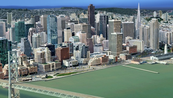
Google Maps is cool and very helpful, but still very limited. 3D city models are slowly being generated by crowd-sourced designers but take lots of time to develop.
C3 Technologies‘ method not only is more accurate, but also much faster. They take multiple passes of aerial photos with DSLRs and using a special computer system, stitch the photos together to create the models and textures. The system is relatively automated and accurate down to 6 inches.
The technology was originally used for missile-targeting systems but now has been adapted for 3D mapping.


Trackbacks/Pingbacks